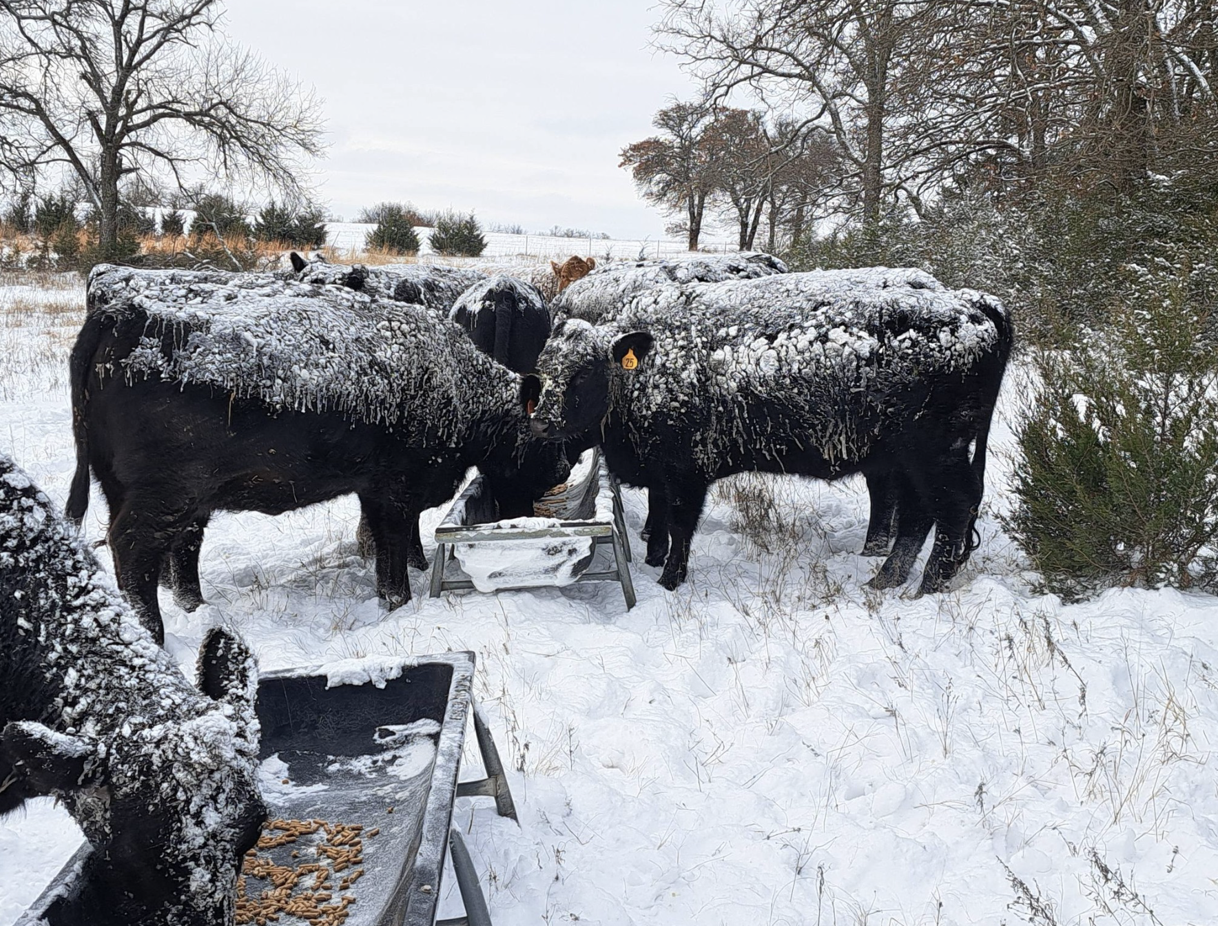
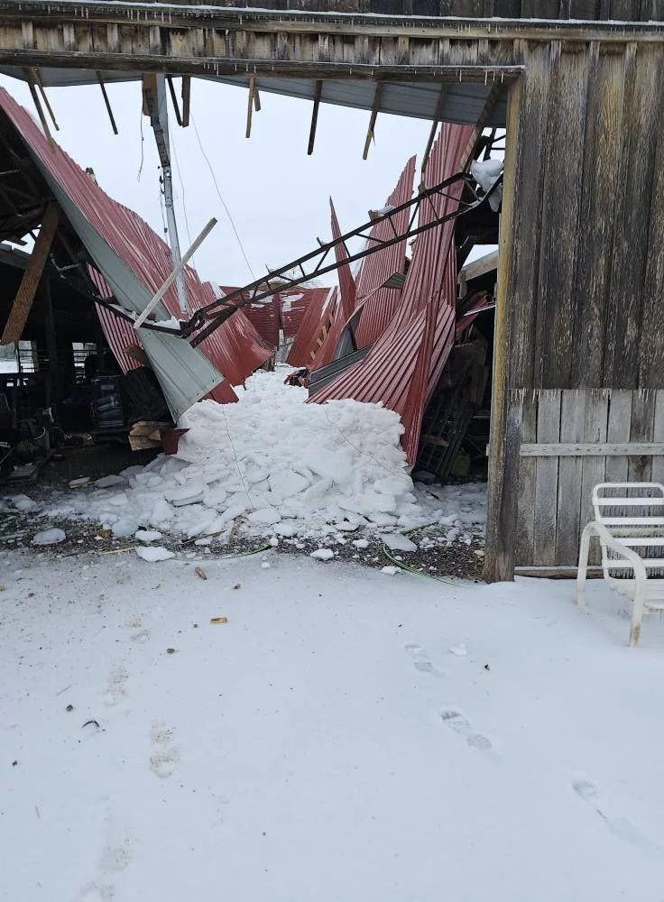
After the Ice: North Louisiana Farmers and Ranchers Assess Devastating Damage from Winter Storm Fern
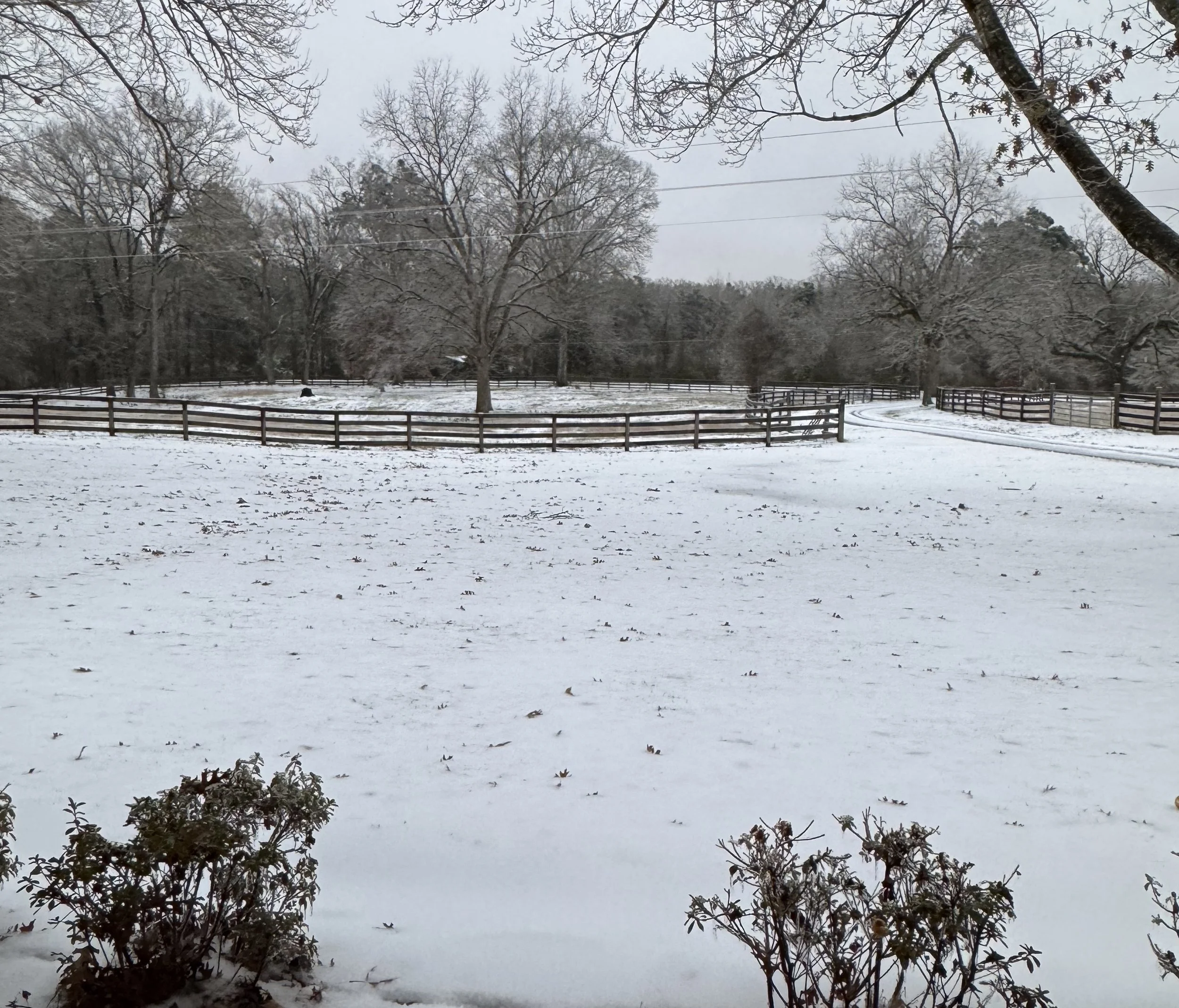
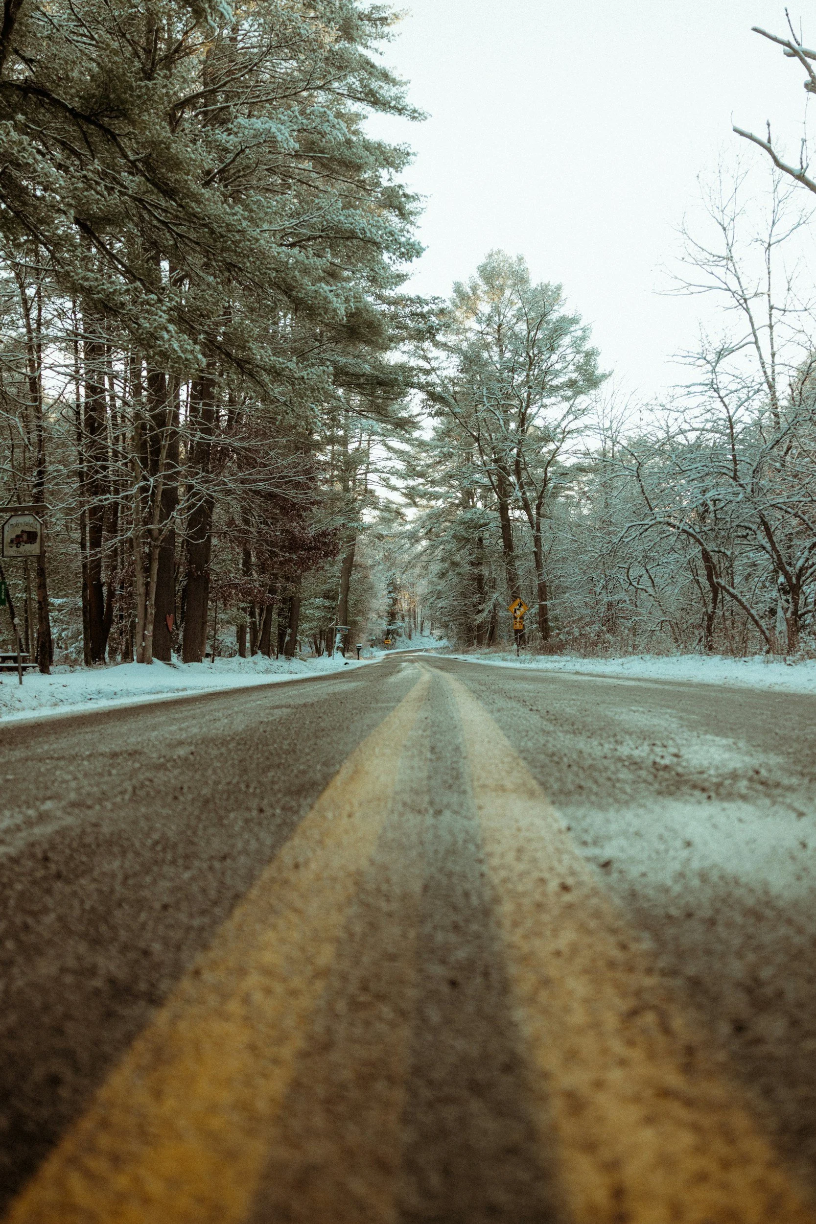
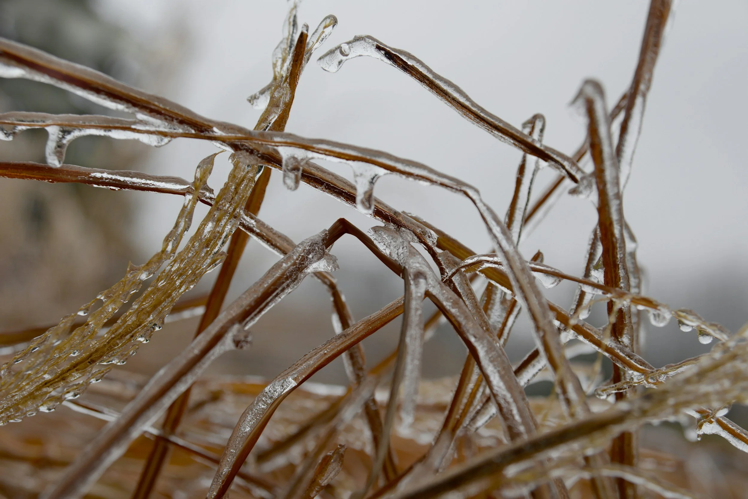
A rare and relentless winter storm left north Louisiana reeling this weekend, as hours of frozen precipitation placed extraordinary stress on farm infrastructure across the region. Poultry houses, barns and sheds were among the structures reported collapsed under the sheer weight of accumulated sleet and ice — damage that farmers say is the worst to hit since Winter Storm Uri in 2021.
Read More
Winter Storms Crush Ag Country as Losses Likely to Top $100 Billion
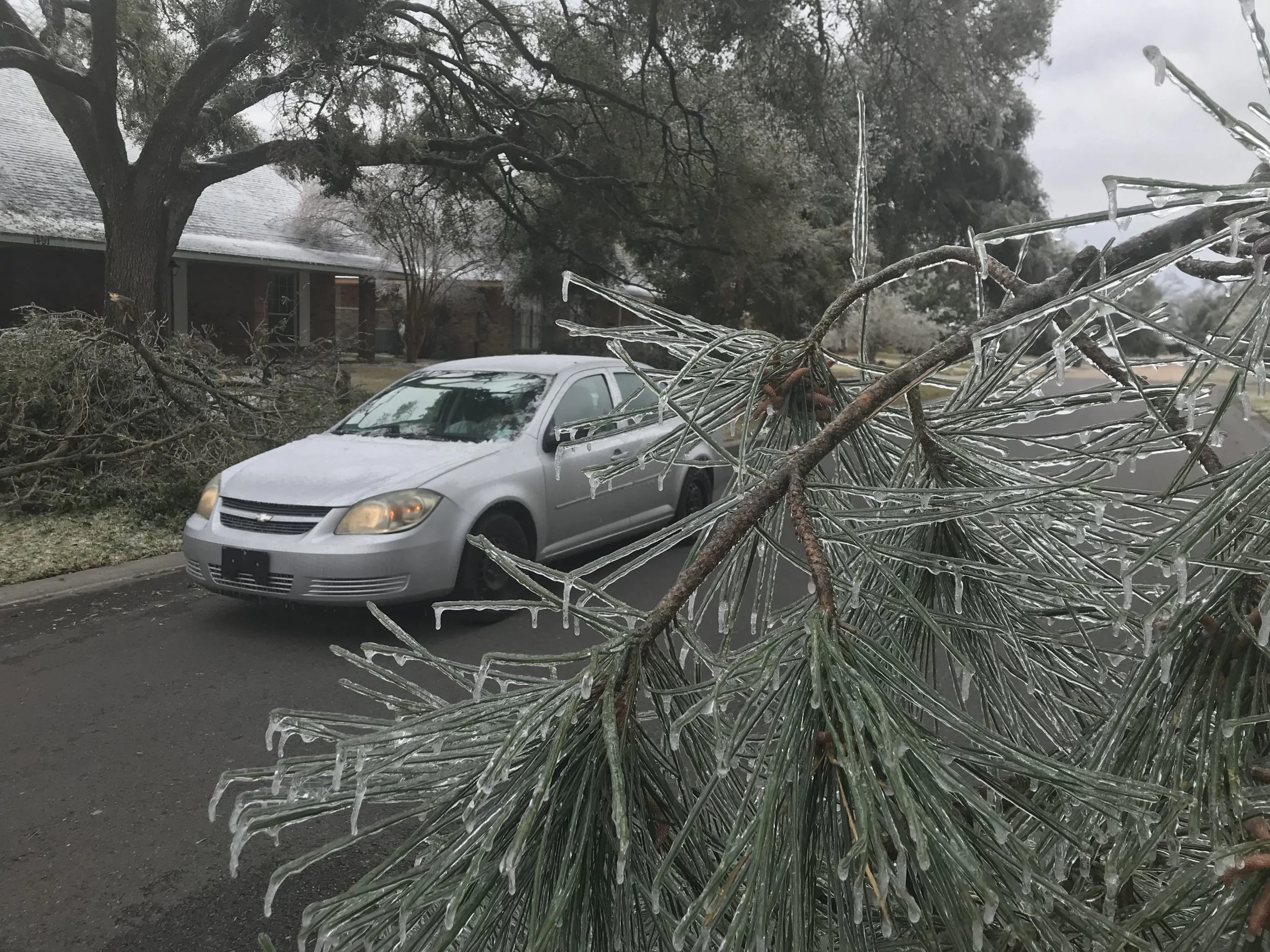
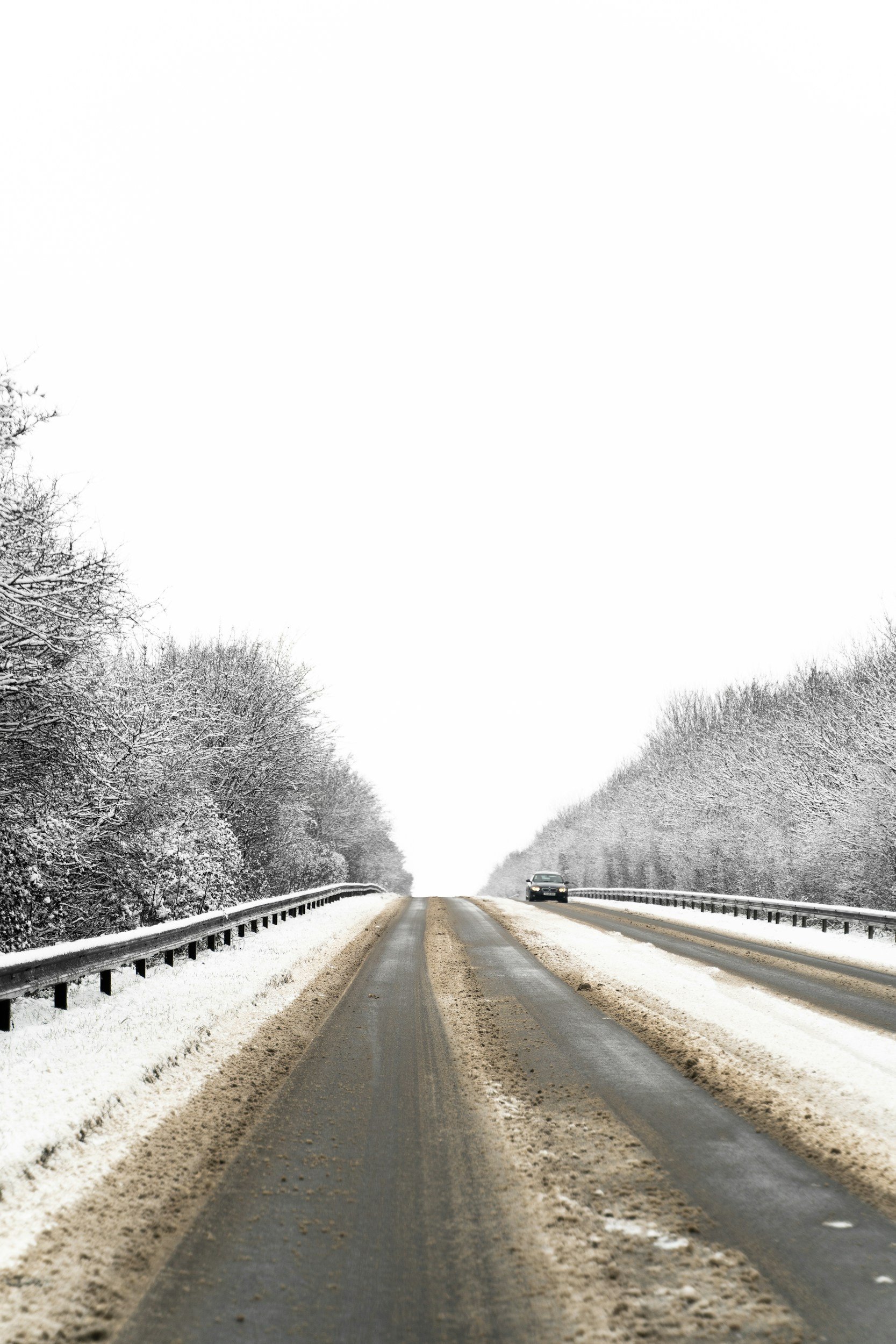
A historic winter storm that swept across much of the United States this weekend is causing widespread disruption to agriculture, with ice, snow, and bitter cold resulting in barn collapses, power outages, livestock evacuations, and mounting economic losses expected to exceed $100 billion.
Read More
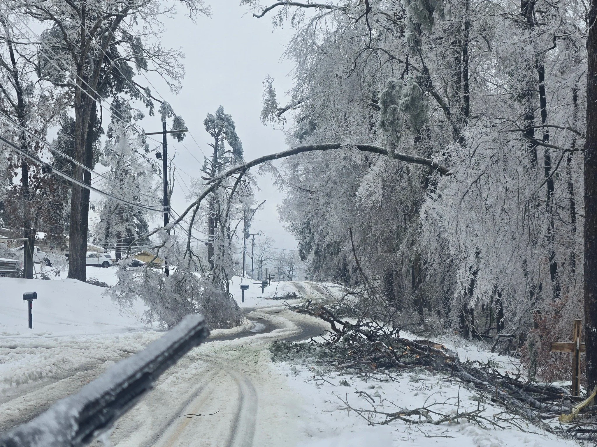
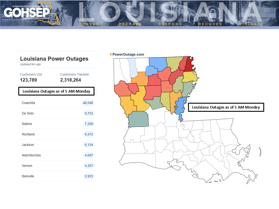
“Hell of a Mess”: Power Companies Scramble to Restore Electricity as Ice Storm Ravages North Louisiana
More than 120,000 people are without power because of the deadly ice storm. Public Service Commissioner Foster Campbell, who represents all of North Louisiana, says Monroe is the hardest hit area of the state as more than 45,000 customers in the parish do not have electricity. Campbell says the buildup of ice on tree limbs has led to many of the outages.
Read More
Winter Storm Preparation and Recovery Resources
Has your agricultural operation been impacted by a winter storm? USDA is here to help you prepare for and recover from blizzards, freeze, frost and other cold weather events.
Read More
Winter Weather Update: Monday AM
Conditions slowly improving across the state ... almost all of south Louisiana is ice-free.
After a bitterly cold start to Monday, most of the southern half of the state should get above freezing during the day, albeit just barely.
Read More
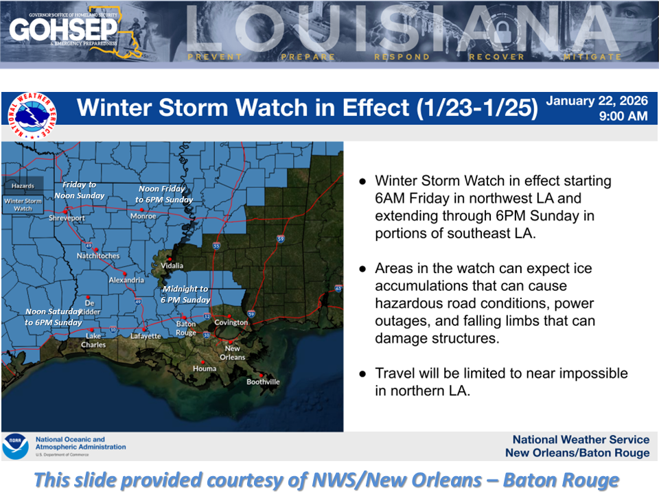
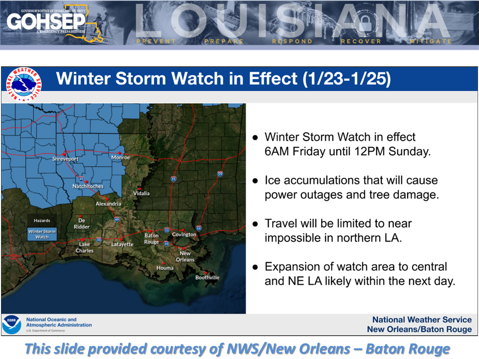
Landry Declares Emergency as Ice Storm and Days of Freezing Cold Threaten Louisiana
Jeff Landry declared a statewide state of emergency Thursday as Louisiana braces for a potentially dangerous winter weather event expected to bring ice, snow and days of freezing temperatures, particularly across the northern half of the state.
Read More
Trump Approves FEMA Help for Louisiana With Winter Storm
The federal government has been approved to assist Louisiana with Winter Storm Fern.
President Donald Trump approved the Federal Emergency Management Agency to assist all 64 parishes with disaster relief resulting from the storm Jan.23.
Read More
Winter Weather Update
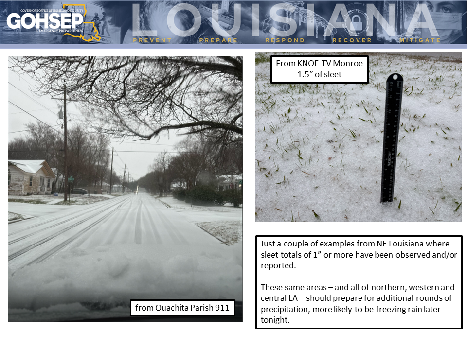
Reports from the NWS offices in Shreveport and Jackson (MS) are noting some significant ice accumulations over sections of northern Louisiana today, mainly in the form of sleet. Community commentary relayed through the NWS indicate sleet totals reaching or exceeding 1” in a number of locations across the northern tier of parishes, especially in parts of NE Louisiana (see photos from Ouachita Parish as examples … and thanks to NWS/Shreveport for posting these).
Read More
Weekend Winter Weather Update: Friday 8:00 AM
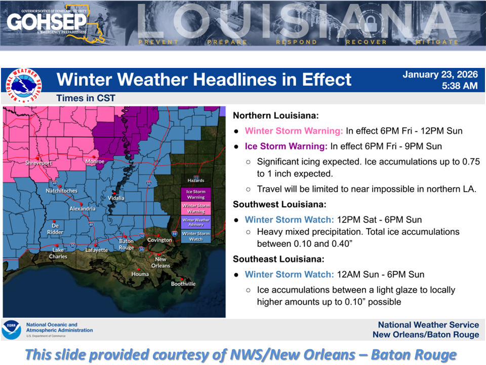
Confidence is "HIGH" for an impactful, dangerous and potentially crippling winter weather event this weekend for north Louisiana ... beginning as early as this evening for northwestern parishes and continuing into next week with bitterly-cold Arctic air.
Read More
Farmer’s Forecast: Ice, Power Outages, and Extreme Cold Ahead
The storm that we’ve been forecasting for days is still a day away for most of Louisiana! There will be wide ranging impacts across Louisiana, and while I won’t get too specific in one given area, I will say that a large part of north and central Louisiana need to be prepared for power outages, followed by very cold temperatures.
Read More
As Louisiana Braces for Severe Winter Ice Storm, DOTD Makes Preparations for Hazardous Road Conditions
North Louisiana could be hit with a significant ice storm this weekend. State Climatologist Jay Grymes says rain will reach the state’s northwestern parishes on Friday, and that rain will eventually turn to freezing rain and spread across the northern half of the state.
Read More
Weekend Winter Weather Update
Confidence is "HIGH" for an impactful and dangerous winter weather event this weekend ... beginning as early as Friday for the northwestern parishes and continuing into next week with bitterly-cold Arctic air.
Read More
Weekend Winter Weather Update
Confidence continues to increase for an impactful winter weather event this weekend ... beginning as early as Friday for the northwestern parishes and continuing into next week with bitterly-cold Arctic air.
Read More
Farmer’s Forecast: Tracking the Ice Threat
A wintry weekend is on the way for a large part of Louisiana, and winter storm watches are already in place across parts of the state. Here's how I see things happening.
Read More
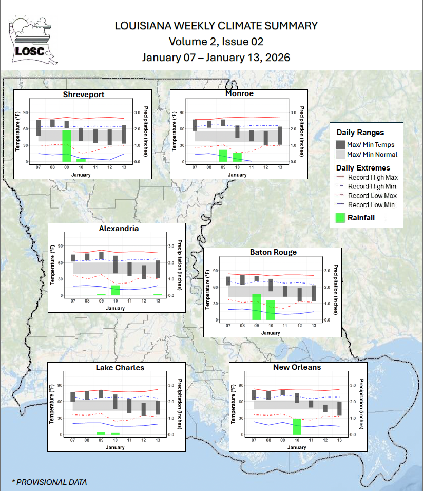
Louisiana Weekly Climate Review - December 31, 2025 – January 13, 2026
Several rounds of rain between Jan 8-10 were associated with a pair of cold front passages on Jan 09 and 10. Those rains came with the first Severe Weather Watch in weeks for Louisiana along with a number of Severe Weather Warnings around the state. The severe weather included an EF1 tornado near Coushatta (Red River Parish) … there were reports of flooding across portions of southeastern and northern Louisiana … some areas of northern Louisiana receiving radar-estimated amounts of more than 3.00” while radar-estimates for sections of southeast Louisiana topped 6.00.”
Read More