
Winter Weather Update
By Jay Grymes
State Climatologist
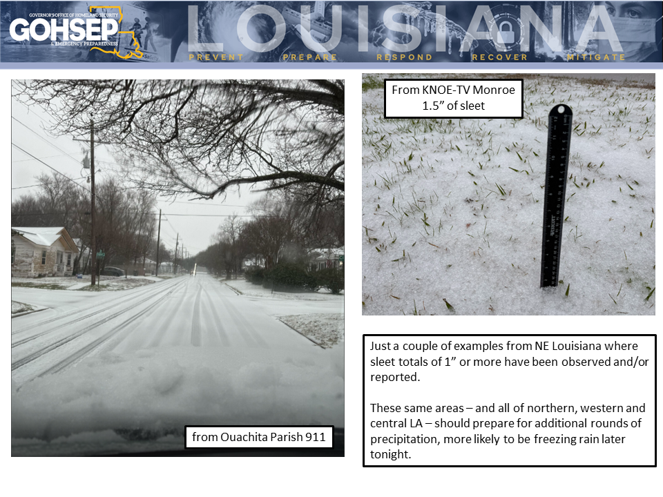
Reports from the NWS offices in Shreveport and Jackson (MS) are noting some significant ice accumulations over sections of northern Louisiana today, mainly in the form of sleet. Community commentary relayed through the NWS indicate sleet totals reaching or exceeding 1” in a number of locations across the northern tier of parishes, especially in parts of NE Louisiana (see photos from Ouachita Parish as examples … and thanks to NWS/Shreveport for posting these).
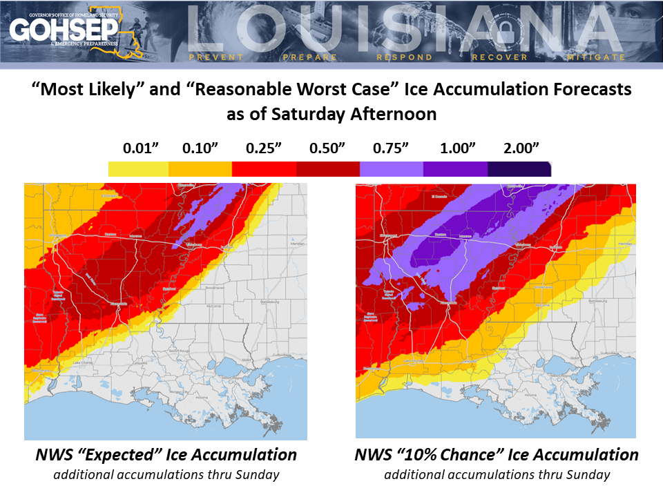
Think of this as “Round #1” … north LA residents should prepare for another round (or two) of precipitation between now and tomorrow (Sunday). Any additional precipitation could come in any (or all) three winter forms: freezing rain, more sleet, and possibly snow.
Temperatures have been running at or below freezing all day for most areas near and north of the I-20 corridor, with 32° temps not far to the north of Alexandria as of 5 PM. Central LA will drop to or below freezing overnight but then the “freeze line” slows its southward advance: it may not reach the I-10/12 east-west corridor (Lake Charles-Lafayette-Baton Rouge) until Sunday evening.
The overall thinking regarding the southward extent of significant freezing rain hasn’t changed much over the past 12-24 hours, although the NWS has been hinting at a slight southward dip, especially for areas east of the Atchafalaya Basin. Freezing rain in Baton Rouge still looks unlikely, but it is certainly too soon to post a ‘zero’ chance for the Capital City. The same is true for the Lake Charles and Lafayette metro areas.
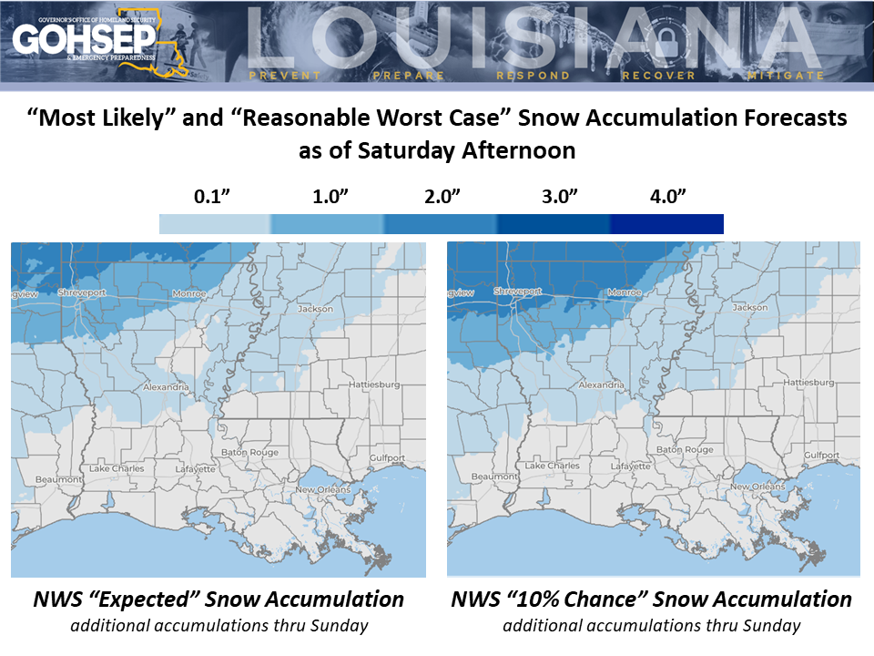
North Louisiana temperatures are likely to remain at or below freezing until mid-day Tuesday and only run above freezing for a few hours at most on Tuesday. If/where snow cover develops over northern parishes, that could mean little to no relief for areas with ice accumulations until Wednesday.
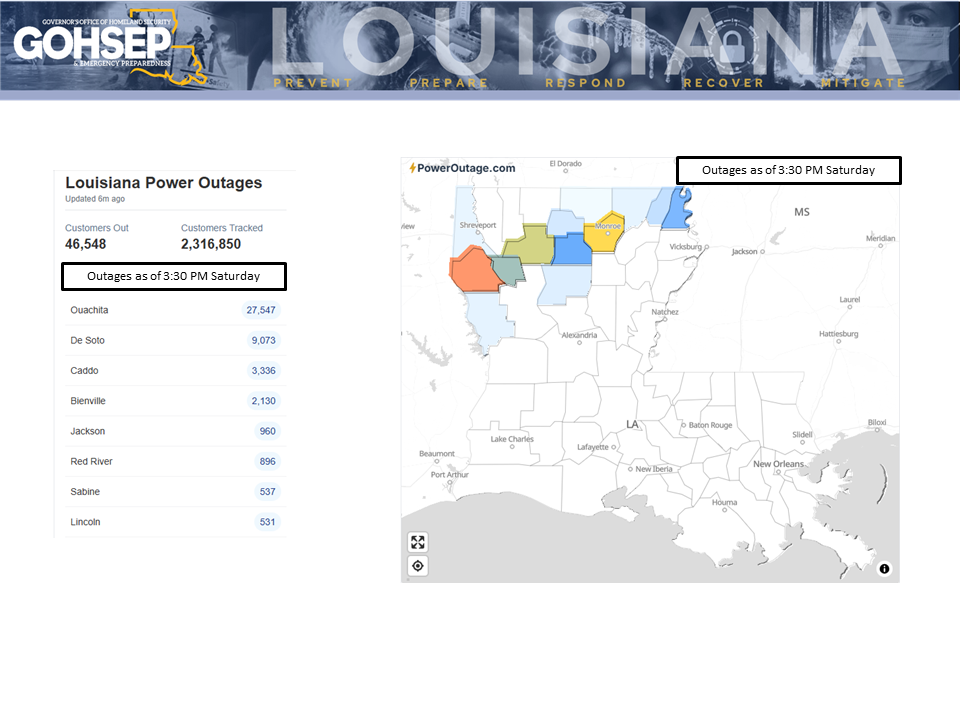
The state is already seeing storm impacts in the form of power outages, and additional infrastructure problems are possible-to-likely in the coming days for communities in the northern half of the state, especially in some of the more rural areas.
'Hard' freezes (25°F or below) will be an issue for much of south Louisiana for Monday and Tuesday mornings and could return on Wednesday morning for some southern parishes.
Thanks to:
Local NWS offices serving LA: SHV, JAN, LCH & LIX
NWS Weather Prediction Center
EMs and OHSEPs around the state
GOHSEP & LSU