
Weekend Winter Weather Update: Friday 8:00 AM
By Jay Grymes
State Climatologist
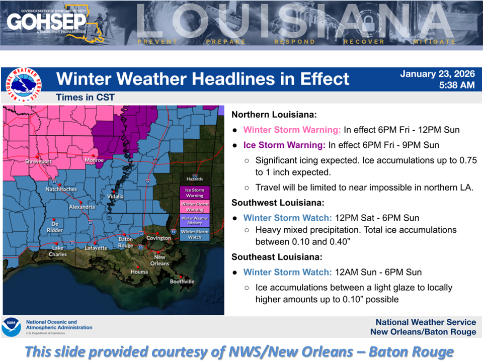
Confidence is "HIGH" for an impactful, dangerous and potentially crippling winter weather event this weekend for north Louisiana ... beginning as early as this evening for northwestern parishes and continuing into next week with bitterly-cold Arctic air.
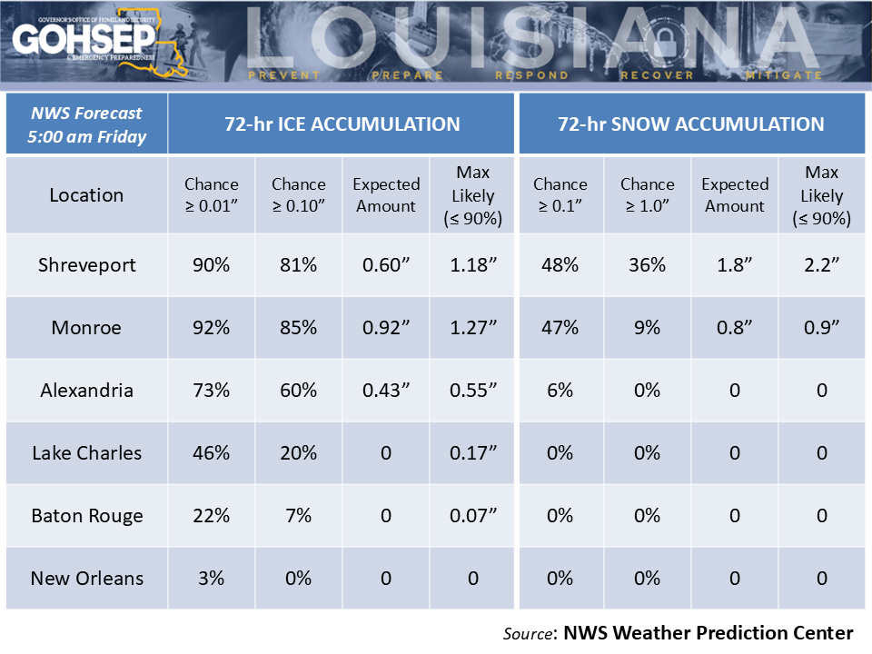
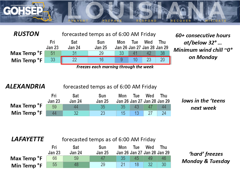
Freezing rain and subsequent icing could result in surface accumulations of 0.5" up to 1.0" (or more) along and near the I-20 corridor. An inch or more of snow could be added on top of that ice, further insulating and extending the duration of the ice glaze well into next week.
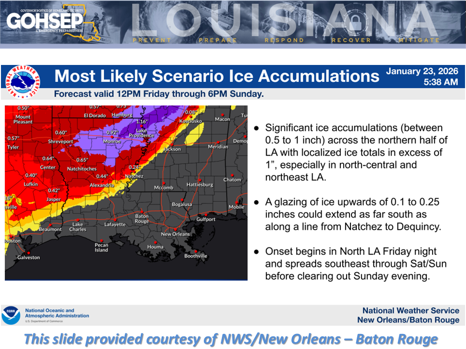
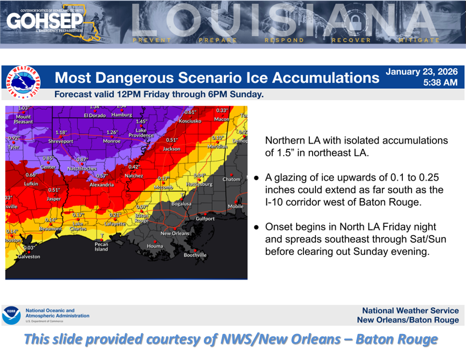
The main threats appear to be north of a Lufkin-Alexandria-Natchez line, although some minor icing south of that line is possible. The threat of significant ice accumulations reaching the I-10/12 corridor is generally 20% or less.
North Louisiana residents should prepare temps to remain below freezing through the weekend with lows dipping to around 10° for Monday and Tuesday mornings. Some northern communities could stay below freezing through Monday as well, with only brief runs of temps above freezing for Tuesday, Wednesday, and Thursday. 'Hard' freezes (25°F or below) will be an issue for much of south Louisiana for Monday and Tuesday mornings.
Power outages and other infrastructure problems could become fairly widespread for the northern half of Louisiana, where the cold weather will elevate the potential for house fires, carbon-monoxide poisoning, and hypothermia/exposure.
(And yes ... already getting multiple calls about another snow threat late next week.)
Thanks to:
Local NWS offices serving LA: SHV, JAN, LCH & LIX
NWS Weather Prediction Center
EMs and OHSEPs around the state
GOHSEP & LSU