
Weekend Winter Weather Update
By Jay Grymes
LSU AgCenter
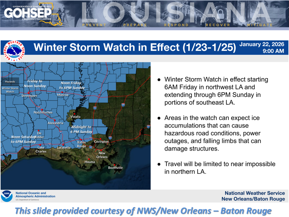
Confidence is "HIGH" for an impactful and dangerous winter weather event this weekend ... beginning as early as Friday for the northwestern parishes and continuing into next week with bitterly-cold Arctic air.
Freezing rain and subsequent icing could result in surface accumulations of 0.5" up to 1.0" for a larger portion of the northern half of the state. These accumulation amounts would be crippling. Add in a 3-day-long continuous freeze: that's a formula for potential widespread closures into next week.
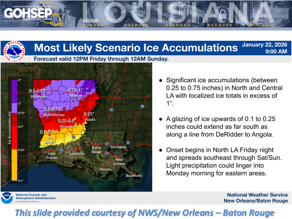
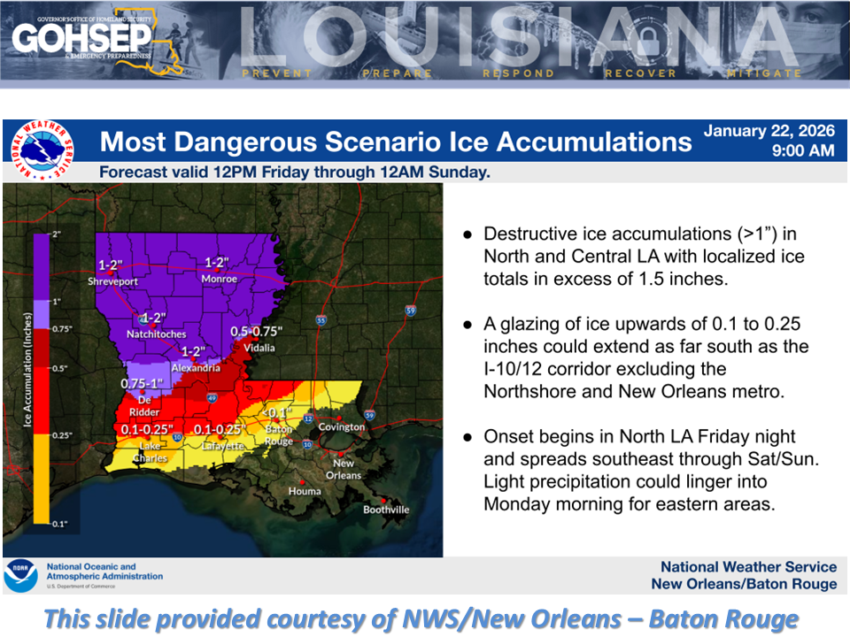
Some cautiously good news: latest guidance has shifted the southern extent of the "icing line" a bit northward, potentially taking the I-10/12 corridor out of the threat zone. However, with more than 2 days to go and still some uncertainty, the possibility of freezing rain reaching the I-10, especially in SW Louisiana is not 'zero.'
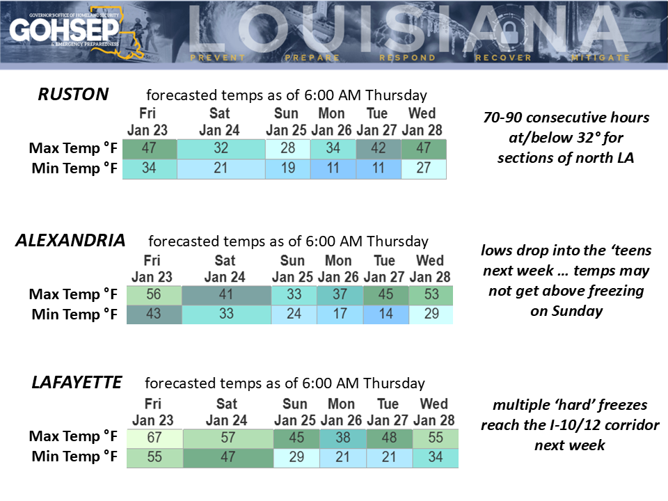
Note the north-to-south temperature trends for Ruston -> Alexandria -> Lafayette. Lows could drop to around 10° near and north of the I-20 with minimum wind chills down to near 0°. While the southern parishes may dodge the icing, 'hard freezes' (25°F or below) will be an issue for much of south Louisiana early next week.
Power outages and other infrastructure problems could range from localized to widespread for the northern half of Louisiana, where the cold weather will elevate the potential for house fires, carbon-monoxide poisoning, and hypothermia/exposure.
Courtesy:
Local NWS offices serving Louisiana: SHV, JAN, LCH ... and a special thank you to LIX!
NWS Weather Prediction Center
GOHSEP & LSU