Weekend Winter Weather Update
By Jay Grymes
LSU AgCenter
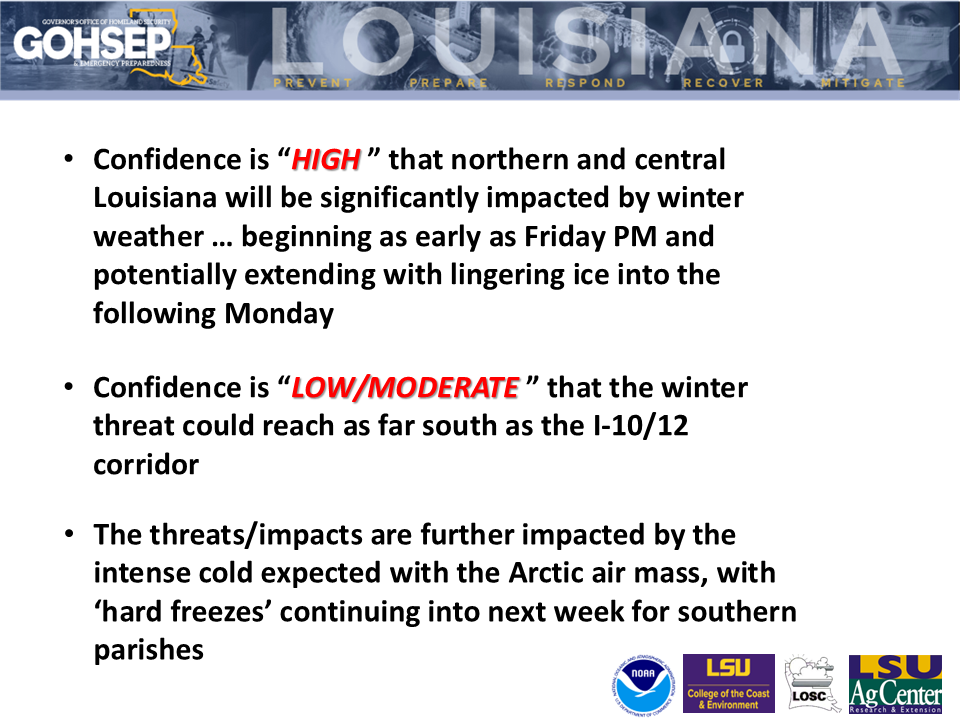
Confidence continues to increase for an impactful winter weather event this weekend ... beginning as early as Friday for the northwestern parishes and continuing into next week with bitterly-cold Arctic air.
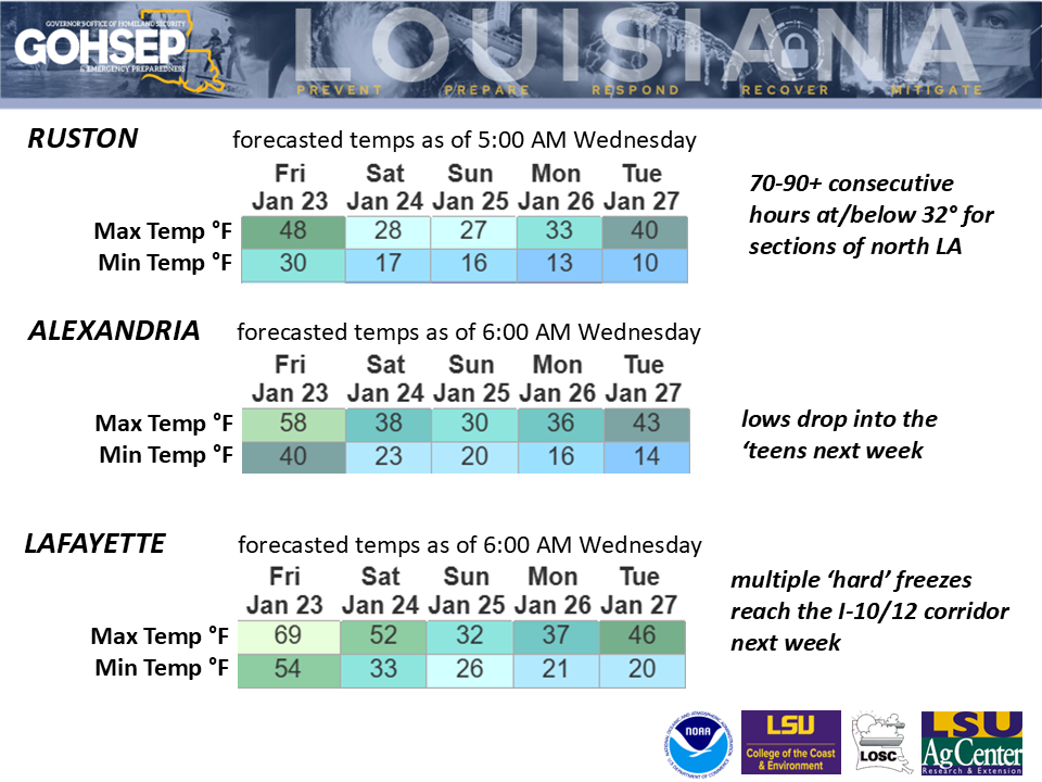
The threat of significant impacts has expanded southward ... with a potential for ice accumulations along parts of the I-10/12 corridor by Saturday evening into Sunday. Additionally, lows for some northern parishes could dip into the single digits early next week with 'hard freezes' (25°F or below) reaching many southern parishes.
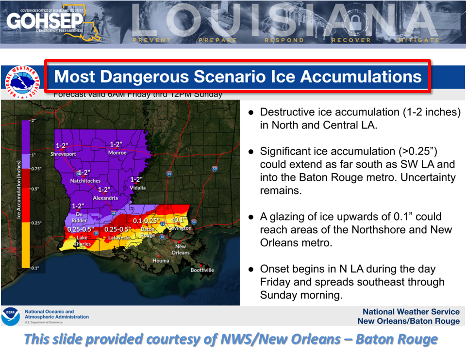
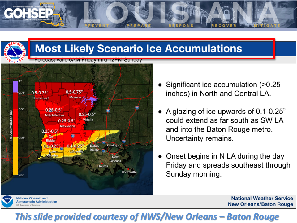
Freezing rain is the most critical threat, especially across the northern half of the state. Ice accumulations could top 0.5" for the northern third of Louisiana with a low-end potential of exceeding 1.0" in places. There is also some potential for the icing to be followed by a layer of snow for the northern parishes.
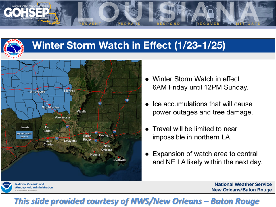
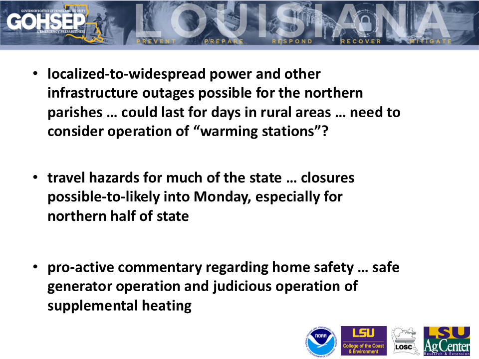
With the extended run of the Arctic air mass currently forecasted, closures may considered into Monday where ice (and snow) lingers.
Power outages and other infrastructure problems could range from localized to widespread, especially in northern Louisiana where temperatures not only might drop to near single-digits in spots, but more importantly, could remain below-freezing for 70 consecutive hours or more.
Courtesy/Thanks to:
Local NWS offices serving LA: SHV, JAN, LCH and especially LIX for sharing slide 1-3
NWS Weather Prediction Center (WPC)
GOHSEP & LSU