
Winter Weather Update: Monday AM
By Jay Grymes
State Climatologist
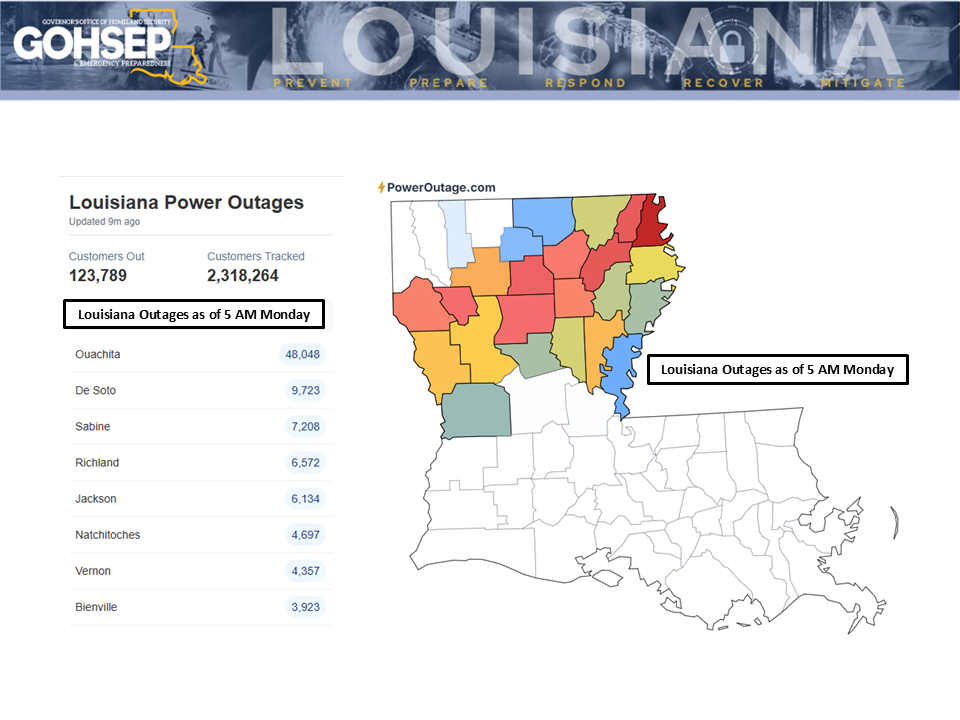
Conditions slowly improving across the state ... almost all of south Louisiana is ice-free.
After a bitterly cold start to Monday, most of the southern half of the state should get above freezing during the day, albeit just barely. Brisk northerly winds will keep wind chills below freezing statewide through the day but sunshine should still help with ice melt in the northern and central parishes.
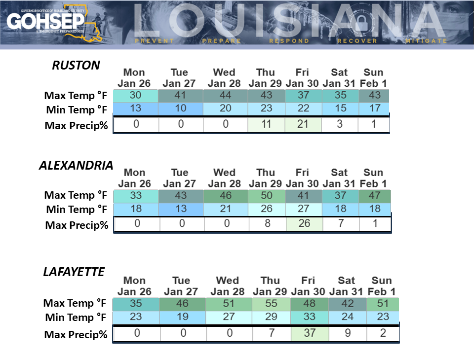
Temperatures statewide will remain well-below normal throughout the week, with morning freezes expected each day for most parishes. A reinforcing surge of Arctic air is expected by the weekend, with lows likely dropping back into the 'teens for more than half the state this coming Saturday and Sunday.
Rain in the form of scattered showers is anticipated for Thursday and Friday, but rain amounts will be limited, especially for the northern half of Louisiana. Current guidance suggests that any rain that does fall is not expected to generate another round of icing nor add to current icing woes. However, given the temperatures expected with those late week showers, parishes should prepare to monitor that event closely.
The outlook from the NWS Climate Prediction Center indicates temperatures are likely to trend below-normal through the first week of February with a return of a drier-than-normal pattern.
Thanks to:
Local NWS offices serving LA: SHV, JAN, LCH & LIX
NWS Weather Prediction Center
EMs and OHSEPs around the state
GOHSEP & LSU