
LA Snow/Sneaux This Weekend?
By Jay Grymes
LSU AgCenter
Our local NWS offices provide regional forecast expertise for the state … and their respective forecast discussions serve as some of the basis for this overview.
Opinions… here are mine:
With social media promoting the potential … and South Louisiana residents remembering Sneaux-mageddon of January 2025, I wanted to get on top of the current forecast(s) for Saturday evening into early Sunday morning as of this morning (Thursday AM).
Keep in mind that we are still roughly 60+ hours out from the potential onset of flakes and/or flurries …
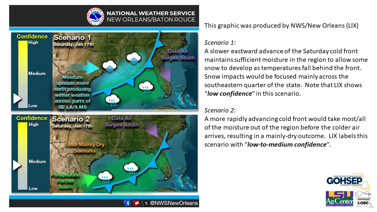
and all four NWS forecast offices (Shreveport, Jackson (MS), Lake Charles & Slidell) are noting low-confidence in the snow potential.
The likely timing for any snowfall would be Saturday evening into the pre-dawn hours of Sunday.
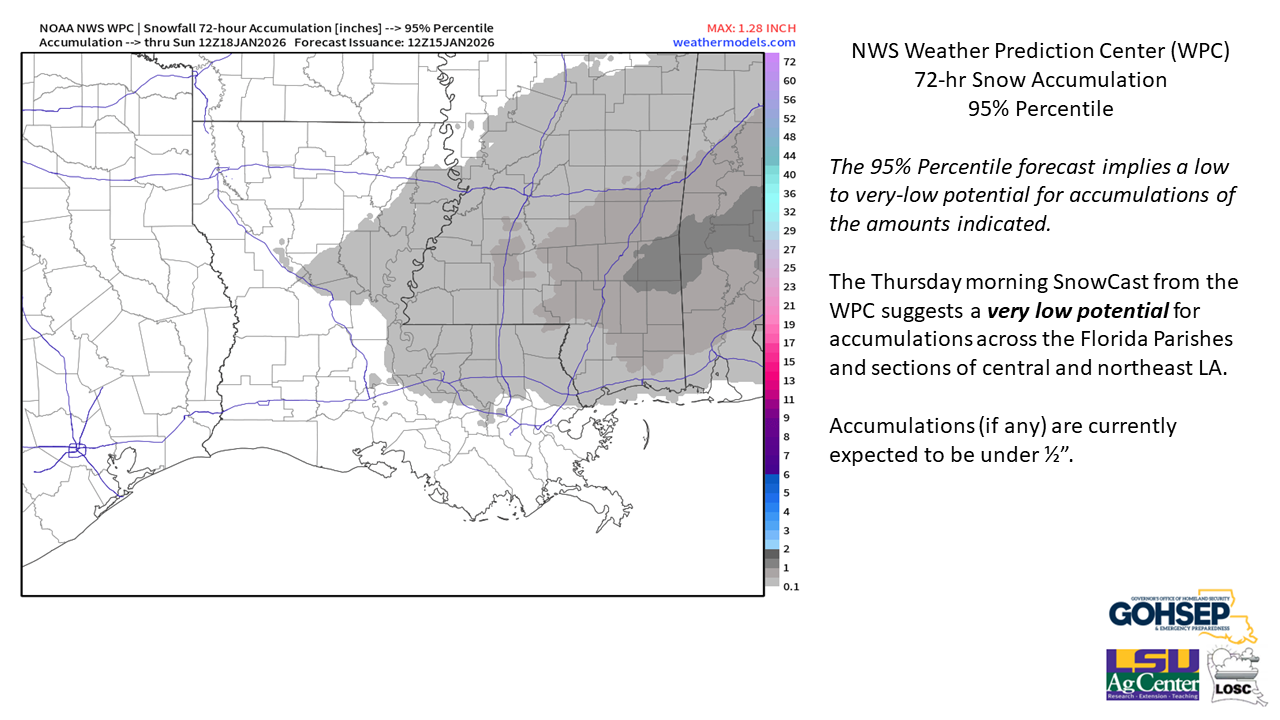
While flurries can’t be completely ruled out, accumulations anywhere in the state appear to be unlikely. Even with falling snow, ground temperatures are likely to inhibit any significant accumulations, although elevated roadways will need to be watched where/if snow does fall as temperatures will dip to/below freezing for much of the state during the Saturday/Sunday overnight hours.
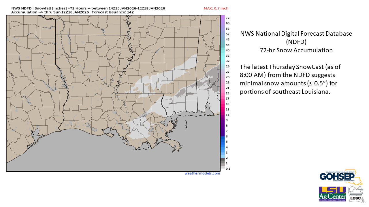
A majority of the latest guidance suggests that if problems do develop it will be focused in the southeastern quarter of the state. At this time, accumulations along and near the I-20 corridor appear to be very unlikely.
Thanks/Courtesy:
NWS Offices serving Louisiana: SHV, JAN, LCH & LIX
NWS Weather Prediction Center (WPC)
WeatherModels.com