
Severe Weather Threat: Today into Early Thursday
By Jay Grymes
Louisiana State Climatologist

Action has already begun today in NW Louisiana, where the NWS has issued a number of Tornado and Severe T-Storm Warnings this morning.
The SPC expanded the region of "SLIGHT Risk" for severe storms today and tonight ... and has issued a Tornado Watch for most of the western half of the state as of 11:25 AM CDT. Additional Watch(es) will be possible later today.

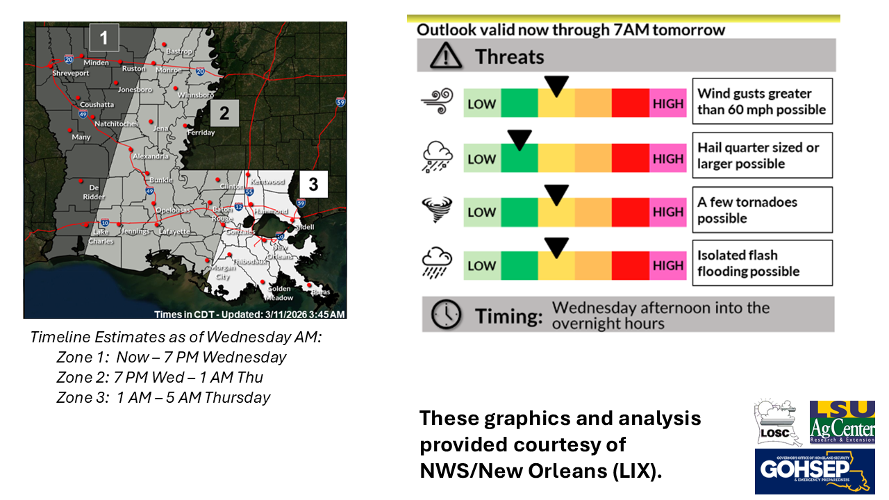
The SPC also has highlighted the potential for those tornadoes that do develop to achieve EF-1 or EF-2 intensities. The SPC also has increased the potential for damaging winds over a number of northern and eastern parishes.


The WPC has issued a potential for localized Flash Flooding to include the upper 2/3rds of the state.

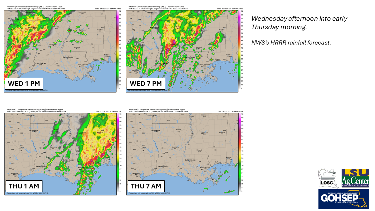
Unfortunately, the timeline for the greatest severe threat for SE Louisiana is from the late night into the pre-dawn hours of Thursday. The one bit of good news is that all of the active weather is well east of Louisiana by the Thursday morning commute.