
Winter Weather Update- Wednesday Evening
By Jay Grymes
State Climatologist
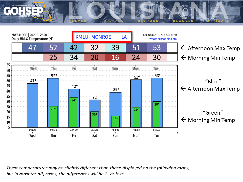
Northern parishes had a welcomed warm-up today, delivering a big “melt” across much of the region.
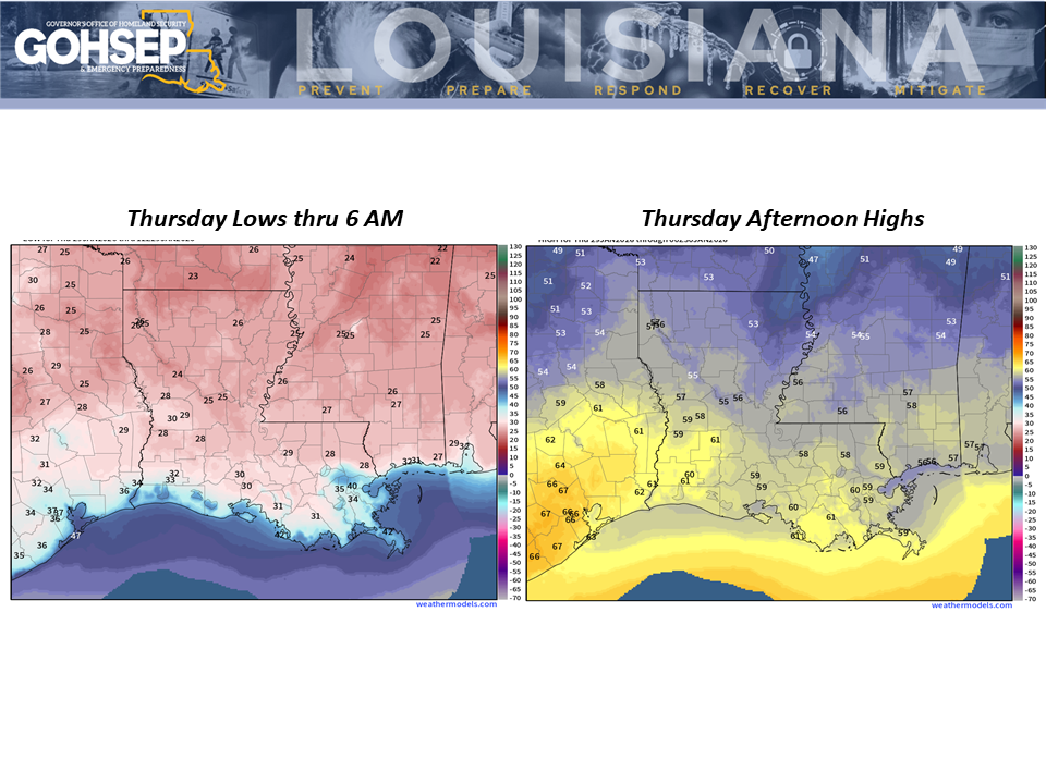
Temperatures will drop below freezing again tonight (Wednesday evening into Thursday morning) for just about the entire state. Thursday (29 Jan 2026) morning lows along the I-20 will dip into the mid 20°s with temps at/below freezing for 8 to 12 hours across the northern parishes. However, north Louisiana temps on Thursday afternoon will get into the 50°s and that should just about finish any lingering roadway snow and ice except where plows and shovels have created piles.
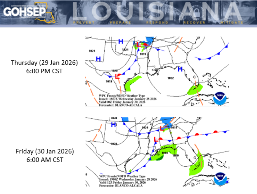
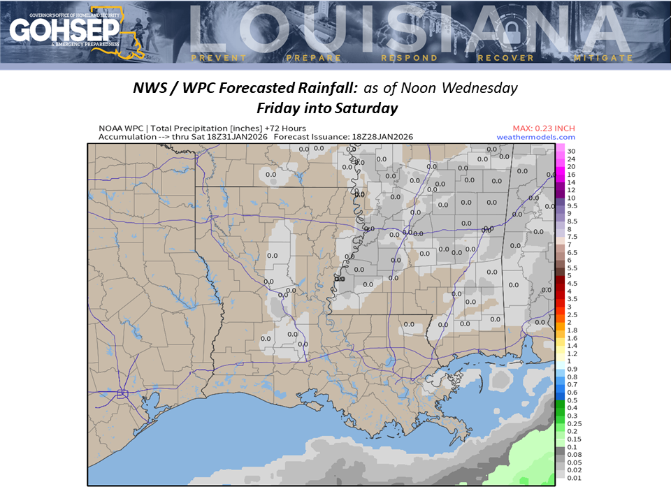
Most of the state stays above freezing for Thursday evening (29 Jan) into Friday morning (30 Jan) as we await the next strong Arctic front, currently scheduled for a Friday passage. Guidance has been bouncing around a bit with regard to the precipitation potential; however, even if we get a few showers or even some flakes (behind the Arctic front), it won’t add to the recent ice and snow dilemma.
What that front will deliver is another bout of extreme cold.
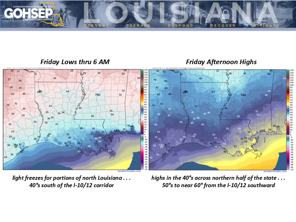
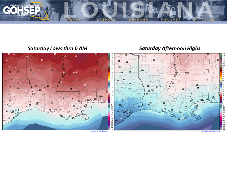
North Louisiana temperatures will drop below 32° on Friday evening (30 Jan) and could stay at or below freezing for sections of north Louisiana until mid-day Sunday (~40 consecutive hours). Plan for lows near 20° along the I-20 for early Saturday morning (31 Jan) with lows dipping into the ‘teens for Sunday morning (1 Feb).
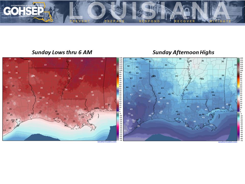
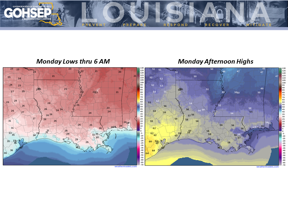
Sunday temperatures for the northern parishes will get above freezing but they won’t stay there long. Lows for Monday’s sunrise are currently forecasted to drop into the mid 20°s across the northern half of the state with freezing temperatures once again reaching the coastal parishes that morning.
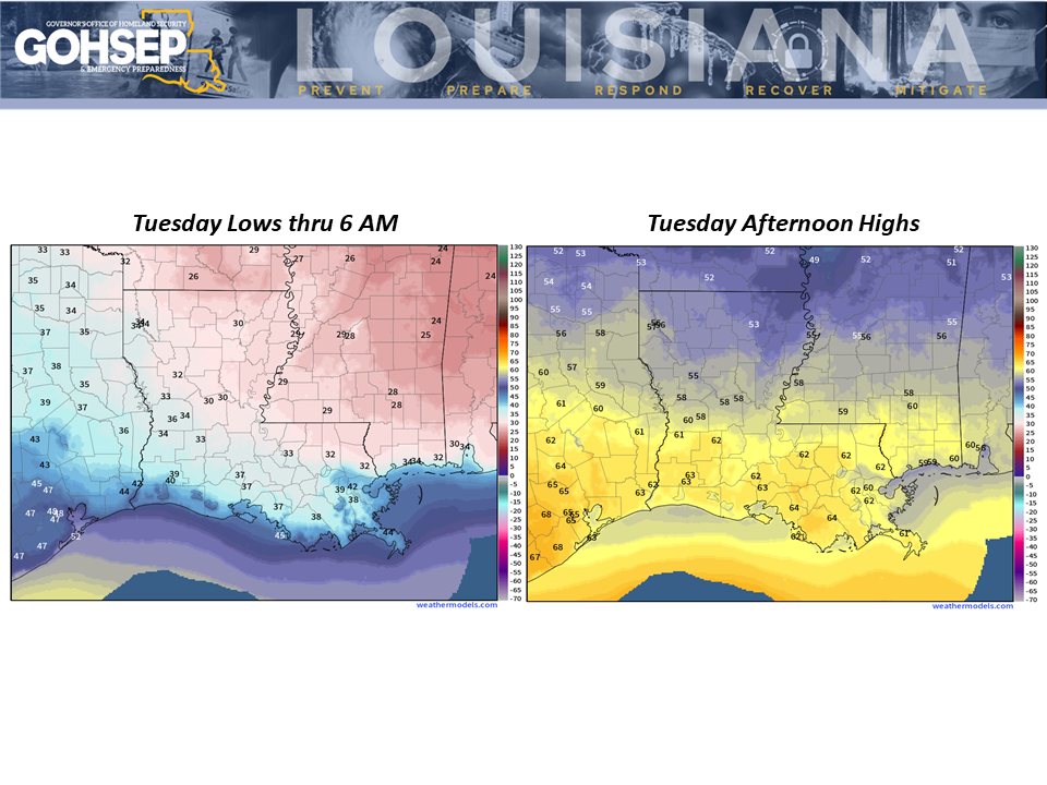
The extended outlook for the rest of next week keeps daily temperatures on the “cold side” of normal all week long.

Courtesy:
NWS offices serving Louisiana: SHV, JAN, LCH & LIX
NWS Weather Prediction Center
WeatherModels.com
GOHSEP & LSU