
Winter Weather Update- Tuesday
By Jay Grymes
State Climatologist
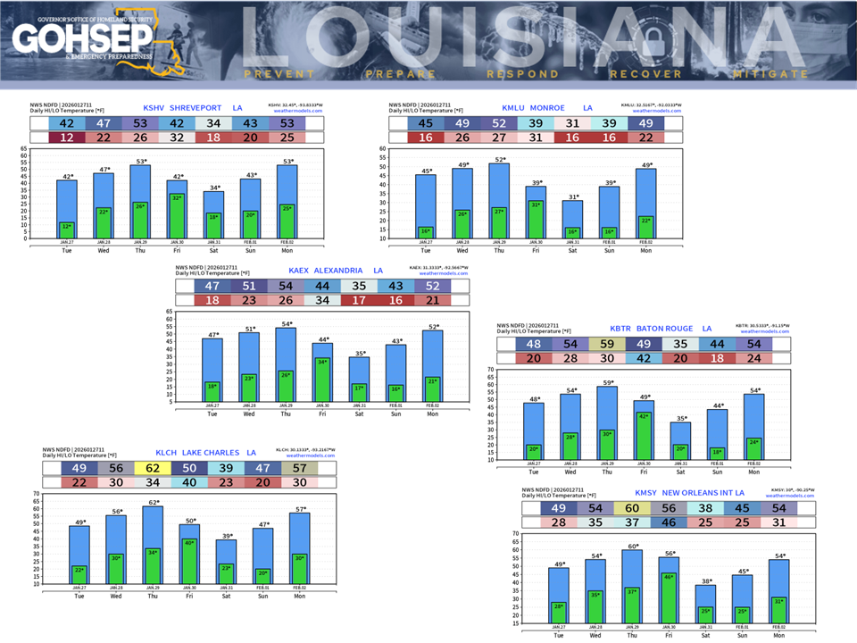
The forecast for the remainder of the week keeps temperatures across Louisiana well-below normal with freezes likely each morning for a majority of northern parishes. However, afternoon temperatures are expected to get above freezing ... and sunshine for the next few days should encourage steady ice melt.
Unfortunately, a reinforcing surge of bitterly-cold Arctic air is still anticipated for the weekend. Lows across much of northern and central Louisiana are currently expected to drop back into the ‘teens for both Saturday (Jan 31) and Sunday mornings (Feb 1), with lows dipping to near 20° along the I-10/12 corridor. The prolonged run of extreme, dangerous cold will continue to challenge infrastructure across much of the state and maintain an elevated threat for residential fires and possible weather-related injures and fatalities.
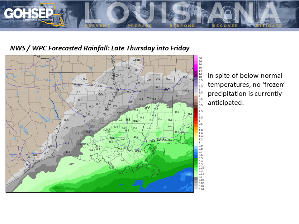
The forecast includes a modest rain chance from Thursday evening (Jan 29) into Friday (Jan 30). At this time, there is no concern for frozen precipitation and anticipated totals for the northern parishes are not expected to add to the current icing woes there.
North Louisiana residents need to remain alert for re-icing of roadways for their morning commutes where daytime meltwaters work their way onto area roads overnight.
Courtesy:
NWS offices serving Louisiana: SHV, JAN, LCH & LIX
NWS Weather Prediction Center
WeatherModels.com
GOHSEP & LSU