
Weekend Winter Weather Threat
By Jay Grymes
LSU AgCenter
This is not meant to sound an alarm (just yet) ... but to send an alert to what may be on the way. Some of what is currently forecasted is sure to change, but the question is "how much change?"
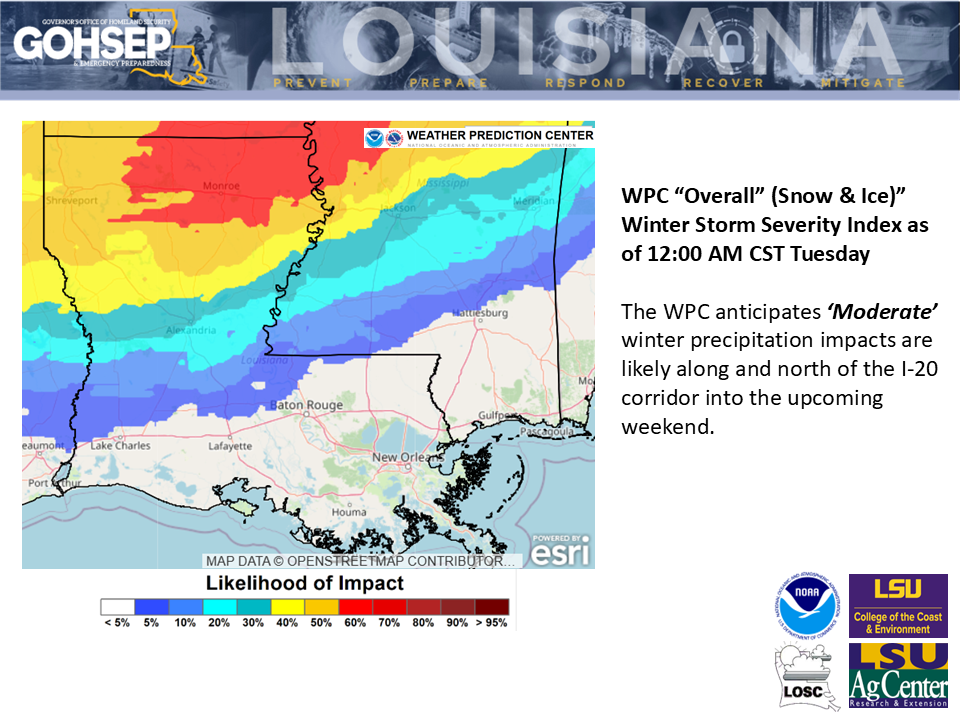
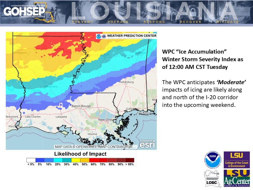
Acknowledging that it is 3-4 days out, confidence for an impactful winter weather event this weekend is increasing, especially for the northern half of the state.
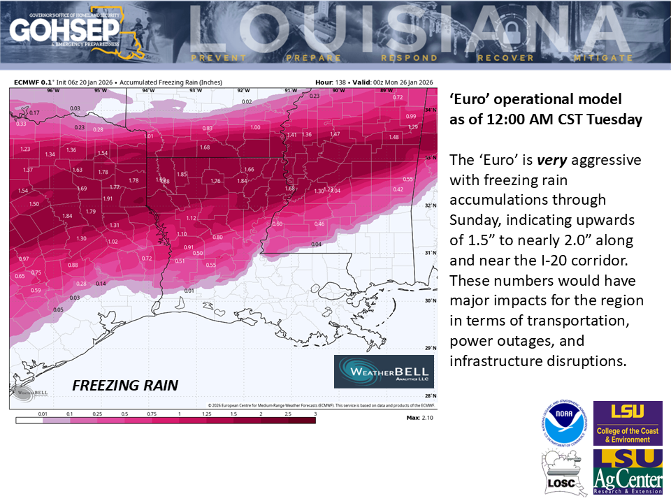
Freezing rain accumulations of 0.5" or more for the northern 1/3rd of parishes currently seems possible based on the latest model runs, with the 'Euro' model being hyper-aggressive with forecasted freezing rain amounts. Just bear in mind that 0.5" is more than enough to create hazardous driving conditions and to generate power outages and infrastructure issues.
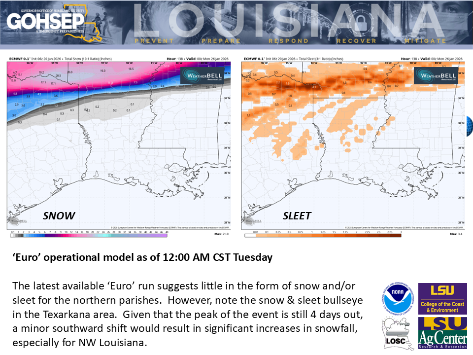
Problems could begin to develop as early as late Friday night for some northwestern parishes and continue across the northern half of the state through Saturday into Sunday. Unlike earlier runs, some indications now bring a modest winter-weather threat all the way south to the I-10/12 corridor and below.
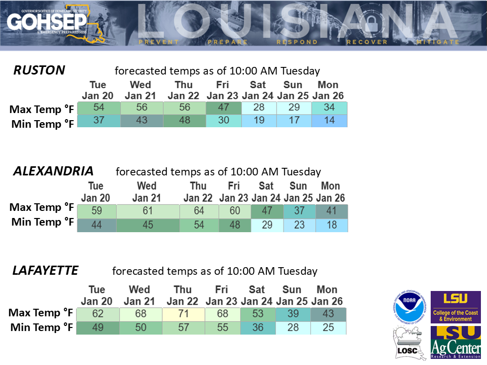
In addition to the wintery weather threats, temperatures will compound the problems, with north Louisiana lows potentially in the 'teens for multiple nights and weekend highs possibly not getting above freezing for areas along and north of I-20. That could mean that icing accumulations could linger into Monday. This could become a serious problem for areas with power outages.
Thanks/Courtesy:
Local NWS Offices serving LA: SHV, JAN, LCH & LIX
NWS Weather Prediction Center
NWS IDSS Forecasts
WeatherBell.com
WeatherModels.com
GOHSEP & LSU