
'Freezer' Tonight... Rains Return Later This Week
Jay Grymes
Louisiana State Climatologist
Most of the state dips below freezing tonight . . .
My opinions and comments.
The NWS provides the state's federal meteorological expertise.
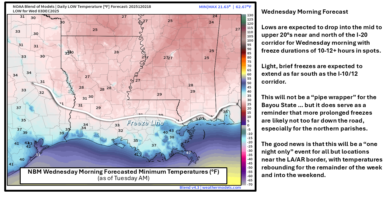
Mother Nature delivers a reminder that we are now in "meteorological winter" (Dec, Jan & Feb) with a freeze tonight into early Wednesday morning. Fortunately, this freeze will be just a "one-nighter" ... temps for Wednesday night/Thursday morning will be still by cold but should be above-freezing for all but possibly a few northernmost Louisiana communities.
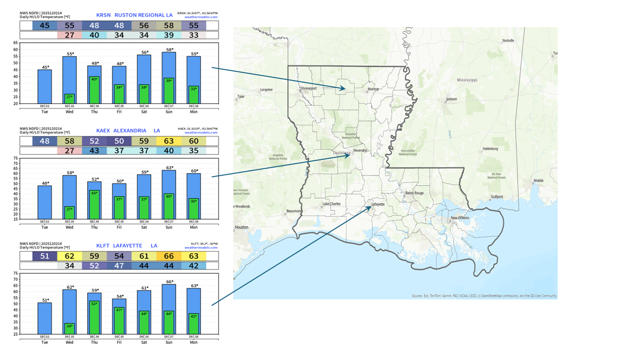
Expect 50°s (north) and 60°s (south) for Wednesday afternoon ... but then another push of 'cool-ish' air, accompanied by rain and clouds, will make for a damp and chilly Thursday and Friday.
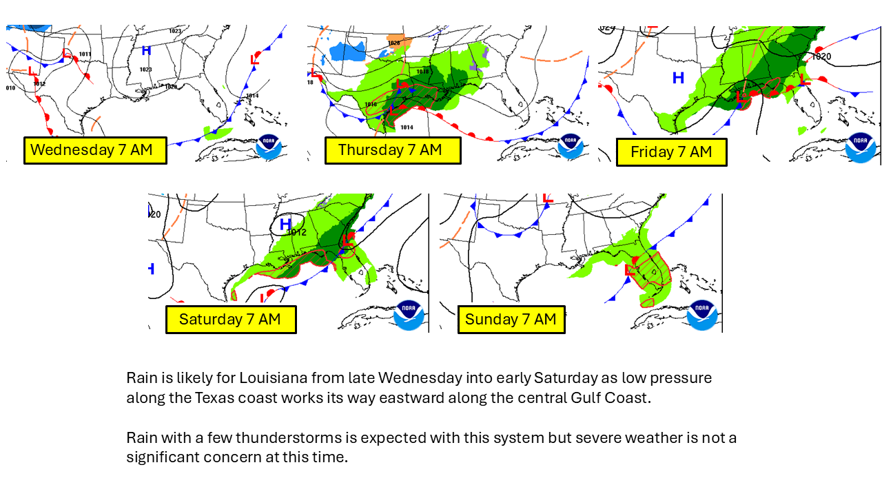
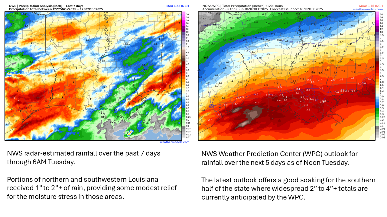
While most northern parishes are expected to receive less than 1" of rain, totals are expected to run between 1" to 3" from central Louisiana down to the I-10/12 corridor.
The latest projections posted by the WPC shows 3" to 4"+ from late Wednesday into early Saturday for areas south of the I-10/12 corridor ... sure to provide some relief for the dry-to-drought conditions there.
Courtesy/Thanks:
NWS Forecast Offices serving LA: SHV, JAN, LCH & LIX
NWS Weather Prediction Center (WPC)
NWS Storm Prediction Center (SPC)
WeatherModels.com
... GOHSEP & LSU