
The Farmer's Forecast: Rain on the Horizon for Louisiana as Storm Systems Move In
By Nick Mikulas
A nice dose of rain is on the way for most of Louisiana, though there will be a wide spread in totals across the state. We did see some scattered showers, and a few storms on Wednesday, and after a mostly dry Thursday, I think things will start to get active toward the weekend.
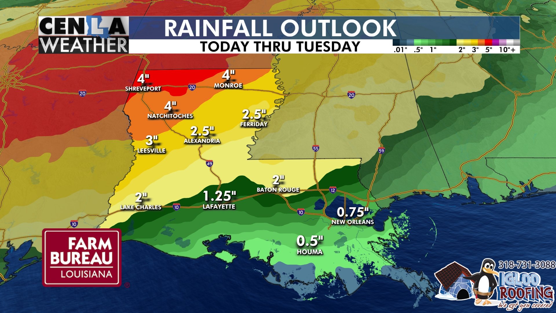
The main show will come in two waves, with wave one rolling through from Saturday into Sunday. There's a low severe threat with this wave, especially over north Louisiana, where some heavy rain is likely to fall. I think the best chance for heavy rain will stay north of a Leesville to Alexandria to Ferriday line.
Beyond the weekend rain, we should keep some scattered showers in the forecast, with the final wave of energy coming through late Tuesday into Wednesday. This should bring showers and storms to the entire state, and I think there will be a pretty solid chance for severe weather. Once we get through all of this, I expect 2-4 inch rainfall totals north of I-10, with some 5+ inch totals possible along the I-20 corridor. South of I-10, it looks like 1/2 to 2 inches, with the lowest totals way down south toward Houma and Thibodeaux. Drought conditions continue to expand, and intensify, so I hope this rain is timed right for what you need. I know that can be a tricky balance!