The Farmer's Forecast: Waterlogged and Worsening
By Nick Mikulas
Louisiana Farm Bureau News/Cenla Weather
A flood watch is in effect from Rodessa to Venice, and Lake Providence to Johnson’s Bayou. If you’re keeping score, that means the entire state is under a flood watch, and most of the state is under that watch until Thursday afternoon. Northern parts of Louisiana should get more of a reprieve on Wednesday, so roughly north of a Hornbeck to Ferriday line, that watch expires Wednesday morning.
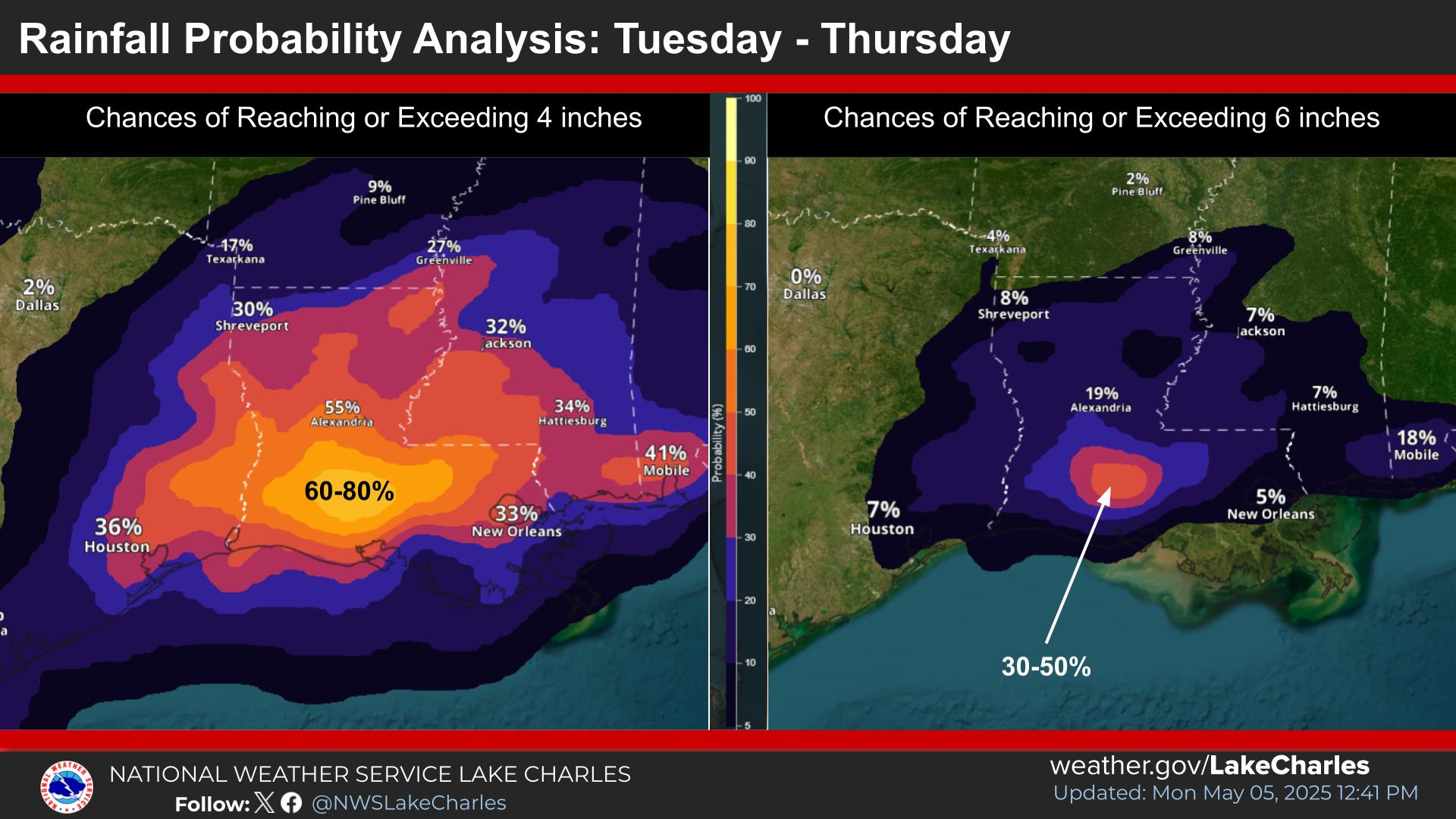
The main idea with this forecast is that rain is arriving more quickly than I thought it would a few days ago, and it looks like at least scattered heavy rain will linger into Thursday or Friday. There is some severe threat with these storms, with isolated damaging wind, and a couple tornadoes possible. While that is most definitely a concern, the widespread threat that will have an impact for most of Louisiana is the flooding threat. Widespread 3-6 inch rain is likely, with isolated areas seeing 10+ inches. The bullseye for the highest chance of very heavy rain is centered around Lafayette. I’ve added that map that shows a 60-80% chance for 4+ inches of rain. That area also has a 30-50% chance for 6+ inches of rain. It’s possible that this fluctuates a bit, but I think that area is the most likely one to get very heavy rain from the Tuesday into Tuesday night wave, with a continued threat through Wednesday. Then we all get another round of scattered heavy rain for Thursday, and perhaps even Friday.
All those words to say that it’s going to get wet, and we are already pretty waterlogged. If Toledo Bend hits 172.5 feet, they open up the gates, and let water down through the Sabine River. This is a realistic possibility, and could create some rapid onset flooding. Areas like Saline/Larto, Spring Bayou, and other areas that see backwater flooding could also run into some problems. I’m sure most of you know your specific area better than I do, so if you are close to flooding, or know that several inches of rain would get you there, you’ll want to be ready to take action ahead of this rain if at all possible. I’ll update later this week if it looks like things will be worse than expected.