Here Comes the Arctic Cold Again
By Jay Grymes
Louisiana State Climatologist
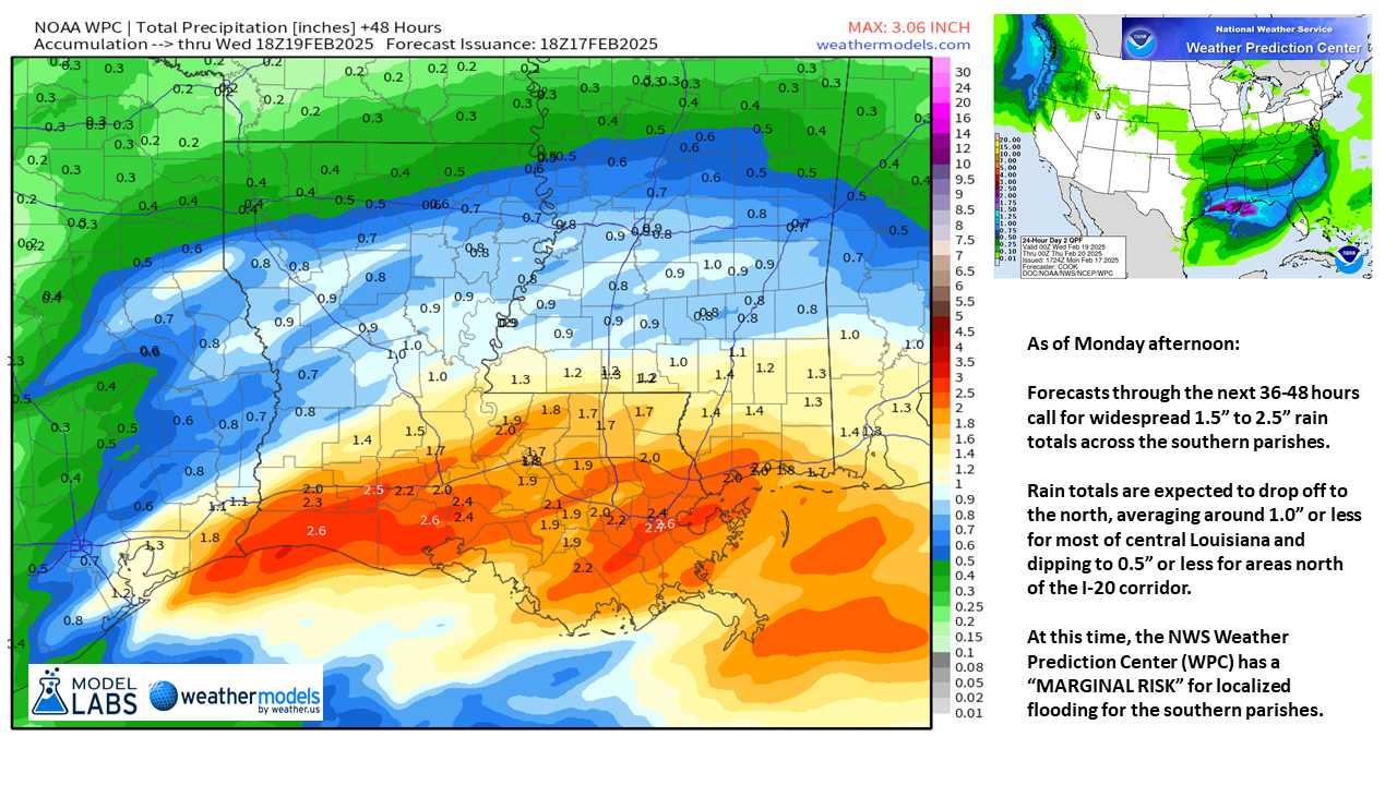
Another Arctic blast is on its way with precipitation in the forecast prior to the arrival of the coldest air.
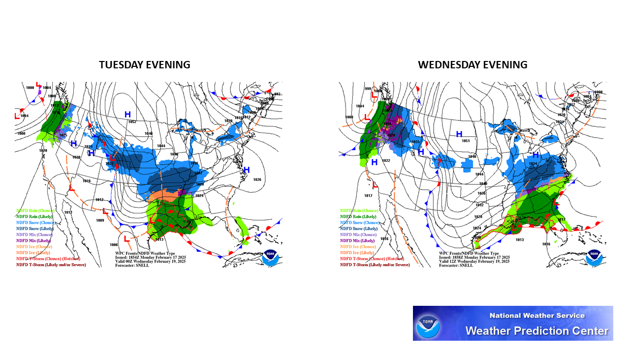
(Un-)Fortunately, no sneaux with this system.
The difference between this week and 4 weeks ago? The Arctic air mass arrives a little too late to create the white havoc. We might hear about flurries and/or light sleet early Wednesday morning in the northern parishes ... but even if that does materialize, there aren't going to be accumulations.
In the worst (and unlikely) case, we could see some patchy, thin icing early Wednesday morning in northern and central Louisiana, mainly on bridges and elevated roadways. And if -- IF -- that were to occur, Wednesday daytime temps would make short work of the ice by/before mid-day.
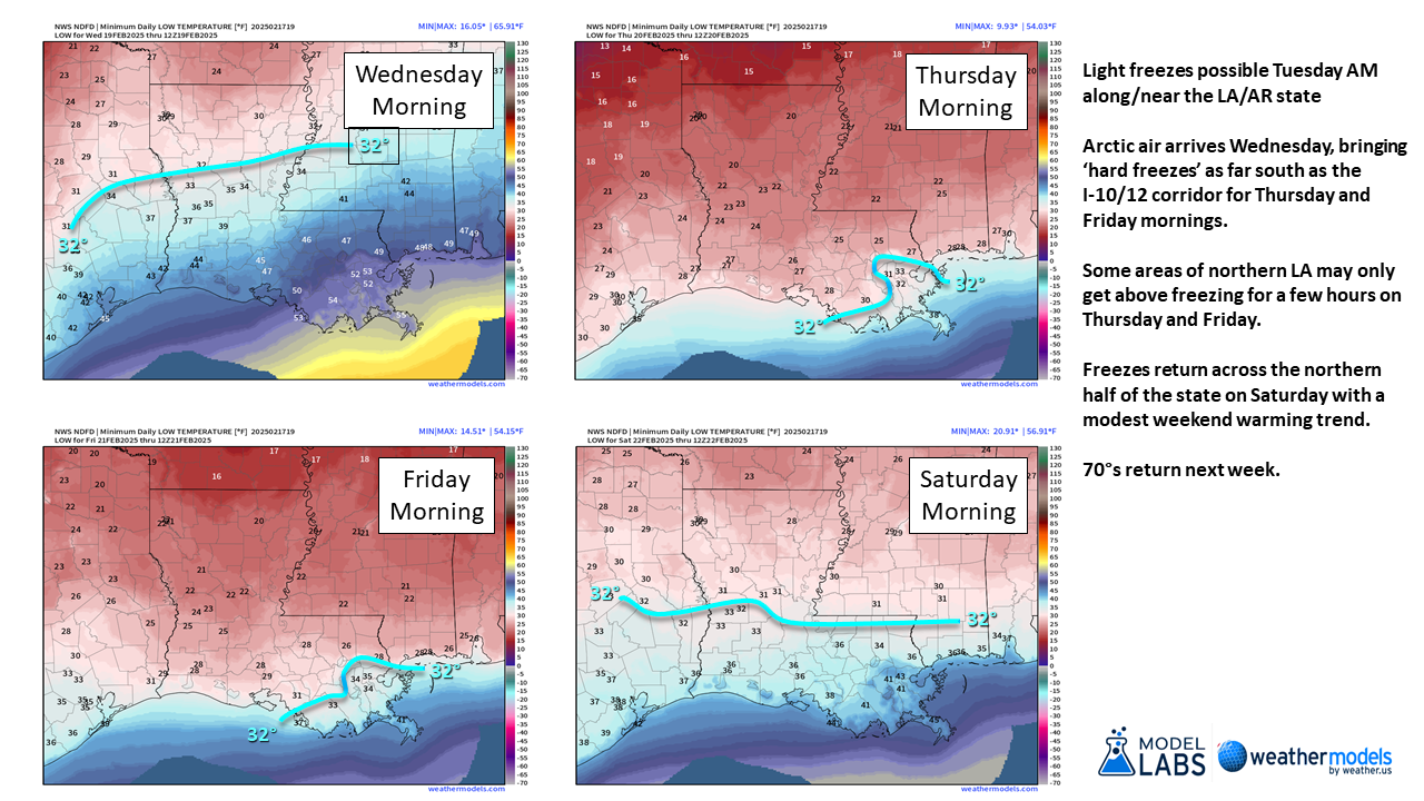
The coldest air arrives Thursday into Friday ... with wind chills dropping into the 5° to 10° range for some parts of northern Louisiana. Wind chills will dip into the upper teens to low 20°s for many southern parishes.
Remind everyone to be extra careful with supplemental heat sources! Pipe wrapping temps for sure across the northern parishes … freeze durations could be a problem for for pipes for much of south Louisiana, too.
The next warming trend starts slowly over the weekend, with temps returning to the 70°s for next week.


