The Farmer's Forecast: Two More Rounds of Rain
By Nick Mikulas
Louisiana Farm Bureau News/Cenla Weather
Last year was one for the ages across Louisiana, and NOT in a good way. I did a brief dive into a comparison of the numbers from this year and last year, since May 15th 2023 was the point where we went from a pretty normal year, to one of the most incredible droughts and heat waves in recent history. I used Alexandria for this exercise since it is right in the middle of the state, and I had already used it for my local update. That's right, I copied my own homework. From 1-1-23 to 5-15-23, we had 26.59 inches of rain. That was roughly 4.5 inches above normal through May 15th. This year, we have had 34.44 inches through 5-15, which is roughly 12.5 inches above normal for the first four-and-a-half months of the year. After May 15th last year, the rain effectively ended, with only 9.32 inches falling from 5-15 to 10-31. We finished last year with 42.23 inches of rain, and it's possible that we will be close to that number by the end of this month. That was a lot of numbers and dates, but the main takeaway is that we are way past where we should be on rainfall totals for this year, and there is more in the pipeline. After this next event, there should be some sort of break, though it doesn't look like things will just stop like they did last year.
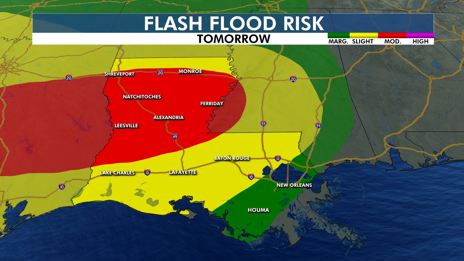
Before that much needed break from the rain, we have 2 more rounds of heavy rain and severe weather on the way. I think the heaviest rain will fall between I-10 and I-20, which covers most of the state. Widespread 3-6 inch totals are likely in that area, with high resolution models showing isolated totals up to 10 inches by the time this system leaves Louisiana early on Saturday. The two waves will impact the state Thursday afternoon through early Friday morning, with another round of storms Friday afternoon into Friday night.
Along with the threat for heavy rain, a threat for severe thunderstorms will spread across Louisiana starting late Thursday afternoon, lasting until early Saturday morning in southeast Louisiana. These storms could once again bring all modes of severe weather, including isolated damaging wind, large hail, and perhaps a couple of tornadoes.
After this clears, all ensemble guidance shows a clear drying trend into next week. It will also heat up into the 90s, so rapid drying will take place. You know better than I how desperately we need this. I just hope we don't get too much of a good thing!


